
Nuuk’s new international airport officially opened at the end of 2024. As a result, United Airlines announced a new direct route from New York (Newark EWR) to Greenland’s capital for June through September 2025. I excitedly bought my tickets not long after.
Booking ten months in advance makes this the most “long-term” planning I have ever done for a trip!
Historically, reaching Greenland from the US demanded an inefficient, exhausting transatlantic detour via Europe, while this new direct flight from NYC to Nuuk only takes 4hr. Our round-trip flight between NYC and Nuuk is operated by United, but then our domestic flights further north from Nuuk (Nuuk ➔ Kangerlussuaq, Kangerlussuaq ➔ Ilulissat) are under Air Greenland. For the last leg of the trip to get back to Nuuk from Ilulissat, we decided not to fly; instead, we chose to take the a 3-day 2-night local ferry of Sarfaq Ittuk.
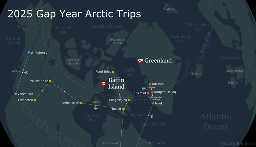
This entire trip in Greenland was packed with new discoveries. I will break down the experiences in Kangerlussuaq, Ilulissat, and the ferry ride into their own separate posts later, because there is so much to cover. This post will focus primarily on the capital, Nuuk.
Flying to Greenland
We first had to fly to NYC to connect to Nuuk. Everything went smoothly with no delays.


Right: Shortly after our flight to Nuuk took off from Newark Airport, we had a clear view of the entire Manhattan skyline.
I had hoped to catch a glimpse of Canada’s Atlantic provinces during the flight from Newark to Nuuk, but unfortunately the weather remained cloudy until we had crossed the Labrador Sea and finally reached the Greenland side. Before landing in Nuuk, we had a clear view of extensive glacial striations on the Nordlandet Peninsula. Towering snow-covered mountains stretched deep into the interior of Greenland just across the fjord, seemingly without end.


We landed in Nuuk on time! That was quite fortunate because warnings about potential issues were widespread. The final days of the caribou migration in late August had staff leave to hunt, creating major flight delays. Shortly after, Nuuk’s first snow during the 1st week of September brought in severe wind and rain and resulted in widespread travel disruption again.
Greenland’s international air hub was Kangerlussuaq for decades, which is a former US military base located right on the edge of the ice sheet (we will visit it later). 2025 is the first year the hub has officially shifted to Nuuk, so I guess operations likely still have some room for improvement.
The new airport terminal isn’t big, but it definitely has a very modern charm.

The high ceilings inside the terminal made people feel spacious and vibrant. Everything was brand new and sparkling.


Nuuk
Nuuk means “Cape” in Greenlandic/Kalaallisut. The city’s former Danish name was Godthåb, which translates to “Good Hope” in English. It sits to the south of the Arctic Circle at a latitude of 64.2°N, slightly farther north than Reykjavik. The city’s population is 20,000, accounting for well over one-third of Greenland’s entire population. As Inuit make up nearly 90% of Greenland’s population, the remaining 10% of the non-native population is largely concentrated here in Nuuk.
Bnb
The guesthouse we found in Nuuk was located just south of the city center and very close to the coast. It was cheaper than hotels and offered a much homier atmosphere. Our host was a kind, elderly Inuit woman.


Right: The Danish children’s television channel Ramasjan broadcasts its cartoon characters being asleep every night from 8:30pm until 6am, explicitly intended to encourage children to go to bed. It’s quite cute, isn’t it?
Most of Greenland operates on UTC-2 timezone during summer and autumn. This is a globally rare time zone as there is very little other landmass situated along the Mid-Atlantic Ridge. Our jet lag was completely messed up for the next few days. Luckily, we managed not to feel too tired since we were only exploring within Nuuk.


The hospital was not far from where we were staying, and we noticed right away that the entire hospital building was painted yellow. This color choice actually ties into a historical story that functional buildings were color-coded by use during the early period of Danish colonization:
- Red for churches and stores,
- Yellow for hospitals,
- Green for communication stations,
- Blue for fish and meat processing plants, and
- Black for police stations.
Although the restrictions on exterior paint colors have since been lifted, many public buildings like churches and hospitals still adhere to this color scheme today to keep this unique tradition alive.


Greenlandic has a very small number of speakers – just the fifty thousand or so people living in Greenland. However, it is not an endangered language because it is still used daily and taught to children in schools. Greenlandic and Inuktitut – spoken across the Davis Strait – both belong to the Eskimo-Aleut language family. But unlike the various Inuktitut syllabic scripts we saw last month on Baffin Island, Greenlandic is written directly using the Latin alphabet.

Urban landscape of the downtown area
My initial expectation for a community of 20,000 residents was something like a little, quiet town. But the moment I set foot here, Nuuk revealed itself to be a genuinely contemporary and dynamic city. The infrastructure is well-developed, the roads are smooth and clean, and the air is so fresh that you can find lichen growing everywhere in the city center. The small houses in the old quarter are properly maintained, with no much trash visible in the yards. The newer districts feature many high-rises, several of which show thoughtful design. Most of the cars on the road are spotless. The buses also look great, though I haven’t had a chance to ride one. Restaurants and shops all accept credit cards, and the cell phone signal is stable. Utilities, including heating, water, and electricity, are fully provided. The tap water, being glacier melt, is perfectly safe to drink directly.
Overall the city looks cleaner and more appealing than the vast majority of small towns in the US, and compared to the Inuit settlements across the Labrador Sea in Canada, Nuuk is simply miles ahead.


Right: Dried fish hanging on the balcony of an older apartment building.


Right: The long Greenlandic words used in a public service message painted on an old residential building give a sense of the language’s “intensity”. “Ataqqinninneq” means “respect,” and “Akisussaaffi” means “responsibility.”
The most modern and impressive part of the city is definitely the commercial district near city center. This area concentrates the major buildings, including the Greenland Government offices, the Katuaq Cultural Center, the Nuuk Center, the Brugsen supermarket, and the Hans Egede Hotel.
The Katuaq Cultural Center was completed and opened in 1997, yet it still looks completely modern today. Its wavy wooden main facade was inspired by the northern lights. The Nuuk International Film Festival was taking place at the cultural center during our visit.

The 10-story Nuuk Center was completed in 2012. The first two floors serve as a shopping mall, while the top eight floors are dedicated to office space. It also includes an underground parking garage. The Nuuk Center is both the tallest and largest building in all of Greenland, and it houses the country’s very first underground parking garage. The gneiss bedrock on which the Nuuk Center sits was, coincidentally, previously sampled by a Danish geologist and dated to be a remarkable 3 billion years old – slightly younger than the one across street from Nuuk Art Museum, which is 3.6 billion years old.

The other small buildings in the commercial district don’t have any overly exaggerated decorations, but they look generally harmonious and contribute to a very pleasant atmosphere.

The Brugseni supermarket is quite large, spanning two floors. It feels very well-stocked and the facilities look modern. Besides most products being imported from Denmark, they also sell locally sourced, formally packaged Inuit raw meat and food items here. This is quite different from Canada and Alaska: in Northern Canada and Alaska, it appears the government does not permit polar ingredients like whale and caribou to enter the official commercial supply chain, so people are limited to buying and selling them privately within the community.


Since we were too lazy to cook at the bnb, we decided not to buy the raw meat from the supermarket and tried a local restaurant instead. Compared to the wild and rustic Inuit whaling village of Pond Inlet in Northern Baffin Island which we visited last month, the Inuit cuisine here in Nuuk is quite refined.


It’s interesting that Thai people seem to be supporting a huge portion of Greenland’s restaurant industry. There are roughly 200 Thai residents in Nuuk, mostly concentrated in the food service sector. Maybe that explains why Nuuk actually serves quite good stir-fried noodles and other Asian dishes. Later on we also encountered Thai restaurants or Thai chefs in Kangerlussuaq and Ilulissat.
Archean gneissic outcrops along the coast
The small peninsula where Nuuk is located is surrounded by the sea on three sides.

Port of Nuuk sits to the east of the city center. It is quite busy with fishing vessels and passenger ferries docking there. Right next to the harbor is a cliff exposing Archean gneiss formed 3 billion years ago.

A set of stairs allows you to climb the cliff, and the view looking back over the harbor is excellent. If the weather were clear, I imagine the view would extend even further.


Then we walked from the east side of the city to the southern coast. There was another gneiss outcrop right at the end of the road where the hospital is located. The surface of the rock here is smooth, largely uncovered by permafrost or lichen. This allowed us to clearly see the gneiss’s various intricate bands, joints, and foliation.


The patterns at each location are vastly different.


Next, we continued westwards along the southern coast, walked past the red church, crossed a meadow, and arrived at the southwesternmost point of Nuuk. Nuuk’s Boardwalk starts here.


The entire boardwalk is essentially nailed directly onto the exposed coastal bedrock. Both the railings and the flooring are made of wood, giving it a solid feel underfoot. Looking west along the route, we could see small icebergs floating around in the fjord, the Nordlandet Peninsula, and the small boats of locals coming and going. The scenery is quite beautiful.


The entire walk takes about 20 minutes, and eventually heads back to the Greenland National Museum in the city center. A further gneiss outcrop stands beside the museum near the locals’ swimming area, directly facing the Church of our Saviour.


Greenland National Museum
We decided to buy tickets and go into the National Museum since we were already right outside of it! The museum isn’t huge, but it has a high density of exhibits, covering a wide range of history, culture, and crafts. It even features several naturally mummified bodies of local inhabitants dating back over 500 years. Thanks to the extreme cold, the bodies are remarkably well-preserved; even the facial tattoos are clearly visible. (For those interested in the mummies, feel free to look up ‘Qilakitsoq mummies’.)


We also noticed that most of the exhibit descriptions were bilingual in Greenlandic and English, with Danish conspicuously absent. The only major display case that did not feature an English translation was the one shown below, which detailed the significance of the ribbon colors used in women’s traditional ceremonial topknots.

Curious as to why only this display lacked an English translation, I looked up the details of the ribbon colors. The findings were quite shocking. Historically, women wore different colored ribbons in their topknots to represent specific marital and parental statuses in the West Greenland region (which includes the main population centers like Nuuk, distinct from the East Coast near Iceland):
- Dark Red: Young woman / teenager
- Red: Unmarried
- Blue: Married
- Green: Unmarried mother/ having a child outside of marriage (Har barn udenfor ægteskab)
- White: Fertile widow/widow still able to bear children (Fødedygtig enke)
- Black: Widow
It is quite harsh that such private personal information had to be publicly broadcast in this way, especially the highly specific statuses represented by the Green and White ribbons. Fortunately, this custom no longer exists in contemporary society.
The museum’s “Traditional Transportation” exhibit is housed in a separate building, disconnected from the main hall. This section comprehensively displays the construction methods and usage scenarios for various types of Inuit kayaks.

It’s important to know that apart from a small forest in Qinngua Valley at the southernmost tip of Greenland, the rest of Greenland is entirely treeless. Therefore, historically the wood Greenlanders used to construct their kayaks had to be sourced entirely from driftwood collected along the coast!
The animal hides covering the frame of the boats were typically made from sealskin.
Old Nuuk
The area north of the museum is called “Old Nuuk.” This was the very first area where the city was established, though the look and feel of this part nowadays is nothing particularly special comparing to other old neighborhoods of Nuuk.

However, this area is home to Nuuk’s most iconic viewpoint: the Myggedalen Panoramic View. Climbing higher revealed a northern vista: a mosaic of colorful small houses set against the towering, distant majesty of Sermitsiaq. Beneath a clear sky, the fjord water turns an unnervingly deep cobalt.

The winding path from Myggedalen viewpoint brought us to the stone beach before the Hans Egede statue. Here the city view opens up clearly revealing the National Museum and its surrounding central structures.

Nuussuaq on the mountain and Qinngorput across the harbor.
After a two-day recharging in Nuuk, we flew to Kangerlussuaq, then Ilulissat, and finally took a two-night sea voyage back to Nuuk, where we spent one final day before returning to the US. We opted to stay in the eastern highland district called Nuussuaq (etymologically Nuuk + ssuaq, meaning ‘Big Cape’) on this last day. This part of the content is not chronologically continuous, yet features in this post due to its Nuuk relevance.
Nuussuaq is an almost independent plateau sandwiched between downtown Nuuk and the new development of Qinngorput. It is separated from the city center by a chasm-like valley to the west. Cars must take a long northern detour to connect, but pedestrians can walk directly through the valley via a steep boardwalk climb. To the east, a bay separates Nuussuaq from Qinngorput. Driving there requires detouring near the south end of the new airport.

Although the weather was often overcast, it could not diminish the bright colors of the various mosses and low-lying plants growing on the permafrost.


The Nuussuaq area is somewhat distant from the main tourist parts and primarily consists of residential buildings. However, their choice of exterior wall colors is no less vibrant than that of the houses in Old Nuuk.

We had our last supper on the eastern slope of Nuussuaq. The new district Qinngorput rests across the bay just beneath the Ukkusissat Mountain. During a brief sunset clearing, the color of the mountain was entirely transformed, looking magnificent under the soft, receding sunlight.

When the lighting is good, the view of Sermitsiaq looking north from Nuussuaq is also epic.

We were treated to a quite spectacular display of the northern lights from our balcony in Nuussuaq on our final night before leaving Nuuk. The lights, green tinged with purple, spanned the starlit sky directly overhead. The aurora’s brightness was so intense that it could even compete with the working lights of the port.


The next morning, we called a taxi to the airport bright and early. It was an easy ride since Nuussuaq is very close to the airport. The beautiful landscapes we saw from the air on the return flight will be introduced in a separate post later 🎉!
PS: a brief note on “chaotic” Greenlandic place names
Greenland achieved initial autonomy in the 1970s, and the Greenlandic government has worked to revert all Danish place names back to Greenlandic (Kalaallisut) names since then. This is a crucial part of the decolonization process, but quite complicated indeed. Apart from towns, famous mountains, and the largest fjords, determining the correct Greenlandic name often requires comparing many different historical versions.
Names for towns and villages are relatively easy to change as there are fewer of them. For example, Godthåb was changed to Nuuk, and Jacobshavn to Ilulissat. When translating these names into other languages, a simple phonetic transliteration usually suffices.
The situation is much more complex for natural features due to several factors:
- Historical Gaps: Many remote peaks, fjords, and glaciers historically lacked any name.
- Inconsistencies: European explorers often assigned conflicting names. Even original Greenlandic names, when transcribed into the Latin alphabet, might differ due to dialectal variations, leading to inconsistent records.
- Descriptive Naming: Historically, Inuit names for natural locations were typically descriptive, using terms like “large fjord”, “large glacier”, or “big island” rather than something more unique or specific, resulting in numerous duplicate names.
Another factor involves the “proper noun + common noun” structure of geographical names. In Danish, the proper noun and common noun are often combined into a single word (e.g., Fiskerfjord, Buksefjorden).
When converted to Greenlandic, the nouns often separate and take grammatical inflections (cases). For example:
- Godthåbsfjorden becomes Nuup Kangerlua. Here, Nuup is the possessive case of Nuuk, and Kangerlua is an inflected form of the common noun element Kanger.
- Some sources phonetically transliterate the inflected proper noun (e.g., “Nuup Fjord”). Others revert the proper noun to its original, uninflected form (e.g., “Nuuk Fjord”). Still others treat the entire Greenlandic compound as a single proper name, sometimes leading to lengthy names like “Nuup Kangerlua Fjord.”
Sometimes the Greenlandic name consists only of a proper noun without an accompanying common noun (e.g., a fjord named Ameralik without the word Kanger). In these cases, translating it into other languages almost always requires adding the common noun (e.g., “Ameralik Fjord”).
Consequently, due to historical data inconsistencies, the decolonization process of switching from Danish to Greenlandic, and the grammatical differences of other world languages, Greenlandic place names often have inconsistent spellings across different maps and resources.