We took a trip to the Yukon this spring! Our itinerary was fairly relaxed: we mostly stayed in Whitehorse, the territory’s capital, and explored the national park to the west as well as nearby First Nation towns.
Whitehorse lies along the upper Yukon River on the eastern slopes of the Saint Elias Mountains. The surrounding valleys create a relatively mild climate compared with other areas at the same latitude, allowing coniferous forests to thrive and pushing the tree line further north. The region has a subarctic climate but receives less precipitation than the Alaska Panhandle to the west. On North America’s west coast (Yukon and Alaska), the tree line sits around 64°N near the Arctic Circle, while on the east coast in Ontario and Quebec, it shifts south dramatically to about 54°N. This explains why Canada’s northern territories, though similar in latitude, differ in vegetation: most of the Yukon can support coniferous forests, whereas Nunavut is entirely tundra.
Southwestern Yukon is also home to First Nation communities speaking Athabaskan languages, as well as a unique gold rush history, making it a fascinating blend of natural and cultural heritage.

Flying up from the US, we first had to clear customs in Vancouver then catch a domestic flight to Whitehorse.


The plane continued heading north after taking off from Vancouver. We could see the various peaks and glaciers of BC’s Coast Mountains through the window when the sky was clear.

The snowy mountains and valleys in the remote wilderness look stunning from the air even if they aren’t famous.


Right: The sharp peak at the lower left of the photo is Ningunsaw Peak on the east bank of the Ningunsaw River. Its cliffs are so steep that snow barely accumulates.
Yukon River
Since we’ve come to the Yukon Territory, we can’t leave without mentioning the Yukon River. The name “Yukon” comes from the Gwich’in word meaning “big river,” originally referring specifically to the Yukon River. The Yukon River is about 3,200 km (2,000 mi) long, making it the third-longest river in North America, after the Mississippi and Mackenzie Rivers. Compared with other famous rivers worldwide, it’s slightly shorter than the Volga, but longer than the Danube, Ganges, Nujiang, and many others. Before our plane landed in Whitehorse, we could see the river’s source at Atlin Lake. From Atlin Lake, the Yukon River flows north through Whitehorse and Dawson, enters Alaska, then runs westwards across central Alaska before finally emptying into the Bering Sea.
I saw the middle section of the Yukon from the air on a previous trip to Alaska. Seeing its source this time felt quite meaningful. Maybe I’ll even get a chance to see Yukon River’s estuary in the future! For those who are interested, feel free to check out my other post: Flying over the northernmost mountains: Alaska’s Brooks Range and Gates of the Arctic National Park.
Although the source of the Yukon River is only about 50 km (30 mi) from the coast, the water must travel 3,200 km northward to reach the sea because of the surrounding mountains. What a remarkable journey. This unique geography also had a major impact on the Klondike gold rush, which I’ll discuss in detail later.


Right: The Yukon River passes through a stretch of coniferous forest before entering Whitehorse.
The Yukon River just started to thaw in April. We could see it running through downtown Whitehorse. The water is remarkably clear. The surface may look calm, but the central channel actually flows quite fast.


Kluane National Park
Where mighty rivers are born, mighty mountains stand guard. The Saint Elias Mountains are part of the northern section of the Cordillera and lie southeast of the Alaska Range. They were formed by the collision of the Pacific and North American plates. Kluane National Park is part of this range and contains Mount Logan, the second-highest peak in North America. Together with Alaska’s Wrangell-St. Elias National Park to the west, British Columbia’s Tatshenshini-Alsek Provincial Park to the south, and Glacier Bay National Park in Alaska Panhandle further south, Kluane forms a UNESCO World Natural Heritage site- a vast international park system.
Haines Junction is about 1.5hr to the west of Whitehorse along the Alaska Highway, which marks the edge of the park.

Pine Lake lies north of the Alaska Highway just before we got to Haines Junction. The lake is completely frozen, but some snow was cleared away that it looked like a local skating spot. Paint Mountain is the massive granite pluton that sits right across the lake. It’s a good hiking spot in the summer, and the views from the top are said to be nice.

It was just lunchtime when we got to Haines Junction. The town doesn’t have many restaurants, but surprisingly there was a Chinese restaurant.


Haines Junction has a visitor center that also works as a cultural center for the Southern Tutchone people. It was closed when we visited, so we just looked around from outside. Currently only about a thousand people still speak the endangered Southern Tutchone language.


Right: The stop sign here uses Southern Tutchone “Ńłān”, instead of the English “Stop”.
The valley where Haines Junction sits marks the boundary between the Yukon River valley plain and the Saint Elias Mountains, the northwest–southeast direction Denali Fault, and the eastern edge of the national park. At this junction, the Alaska Highway splits along the fault into two branches: turning north leads to Dawson, while heading south follows the Haines Road, which continues through British Columbia all the way to the Alaskan coastal town of Haines. We went south though this time, but we didn’t drive the whole way.

About five minutes south along the road, we got to the Auriol Trail which leads deep into the national park. But no one was there since the snow hasn’t melted yet. Apart from the occasional ravens, it was completely silent – barely any ambient noise at all. It’s quite peaceful.


After Auriol Trail, we continued south and then reached Kathleen Lake. The main part of the lake lies on the west side of the highway, while the smaller eastern section is called Lower Kathleen Lake.


Many people would come here to camp and fish in the summer, but it was still too cold in April and most of the lake remained firmly frozen. No one else was around.

We turned back and headed home after seeing Kathleen Lake.

Whitehorse
The Yukon Territory covers about 480,000 km2, larger than countries like Japan, Germany, or Sweden. But the total population of Yukon is only 47k, with 30k concentrated in Whitehorse. Whitehorse is much more industrialized than I expected and even has Chinese restaurants of a respectable standard.


Right: My first taste of Mauritian cuisine happened in the Yukon, as unexpectedly quirky as my first experience with Moldovan food in Fairbanks, Alaska.
The Whitehorse area was a gathering and trading place for various native tribes for thousands of years. Then the 1896 Klondike Gold Rush brought a large influx of settlers, rapidly developed Whitehorse and Dawson into important towns. The famous writer Jack London wrote his classic works The Call of the Wild and White Fang after coming to the Yukon during the gold rush.
There were two main routes for prospectors coming from the south during the Gold Rush. The first and most iconic one was the Chilkoot Trail that led up the steep and icy Chilkoot Pass from Skagway, Alaska. The other was a fully water-based route: sailing around the southern tip of the Alaska Peninsula and the Aleutian Islands into Bering Sea (!!!), reaching the Yukon River mouth, then traveling upstream.
It only takes about 2 hours and 10 minutes (175 km) to drive to Skagway from Whitehorse nowadays, but over a century ago, the rugged mountain route was so difficult that many preferred the much longer sea route via the Aleutians, giving an idea of how grueling the Chilkoot Trail journey was.


The Kwanlin Dün Cultural Centre stands on the banks of the Yukon River in downtown Whitehorse. The public library is right next to it. The center was hosting an event commemorating the 20th anniversary of Kwanlin Dün First Nation’s Final Agreement and Self Government Agreement when we visited. It was very lively.


Whitehorse has quite a few craft shops, many featuring handmade items by local First Nation artists. It’s nice to go for a look when you have some free time.


Just a little north of the city, there’s a creek called McIntyre Creek, with several nice viewpoints along the way. We also spotted two bald eagles in the valley, but they were too far away for photos.

The Yukon Wildlife Preserve is to the north of McIntyre Creek. Not many people were there when we visited. It felt really nice to just wander around in a huge zoo without dealing with crowds. The moose were too well hidden to see, but we spotted all other native Arctic animals such as muskoxen, lynx, caribou, mountain goats, and bison.


The Takhini Hot Springs are right next to the wildlife zoo. Relaxing in the steaming pools while snow blankets the surroundings feels especially memorable. The front desk doesn’t provide much, so you’ll need to buy or rent items if you forget anything. I recommend bringing your own towel and slippers.


Early April marks the tail end of dog-sledding season, so we set aside an extra day to try a same-day dog-sled tour. We headed up the mountain in the morning, had a simple lunch on the trail, and returned in the afternoon.
We first got acquainted with our dogs after meeting up with the guide in the morning. Our guide explained that each team of four must include dogs of different ages and ranks; otherwise they might fight when running. After learning the basic techniques, we set off into the mountains. The temperature that day had just risen above zero, so it wasn’t very cold for us. But it was actually warm for the dogs – their ideal comfort zone is around -20°C (-4°F).


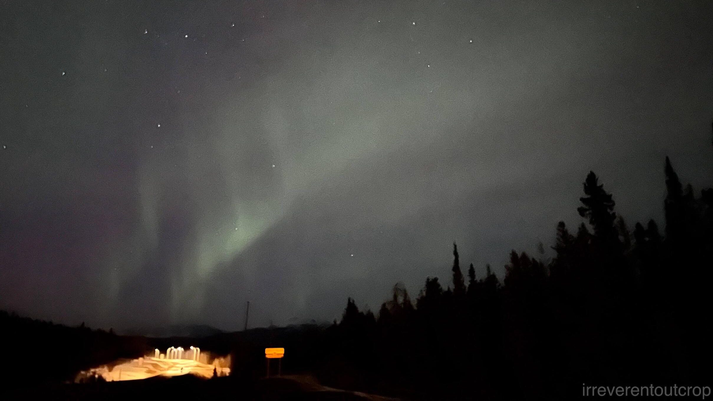
As for the northern lights, forecasts had predicted them for the days we were in Yukon, but we only saw a faint display one night by the roadside. Most other nights were unfortunately cloudy.
Carcross
One day we drove south from Whitehorse along the Klondike Highway to the small town of Carcross. The Klondike Highway continues further south all the way to the border with British Columbia, then Alaska, and eventually the coastal town of Skagway. We turned around at the BC border since we did not have enough time to reach the end.

Before reaching Carcross, there is what’s called the world’s smallest desert. It’s actually not a true desert but the lakebed sediments left behind when an ancient glacial lake receded. Strong winds in the dry microclimate continually move the fine sand and form dunes.

Carcross is the territory of the Carcross/Tagish First Nation, with a population of around 300. The name “Carcross” originally meant “Caribou Crossing,” later shortened to Carcross. The area is surrounded by numerous lakes and offers beautiful scenery. Many shops in town only open in summer though, so the whole town felt rather quiet in April.
The lakes here all have long and narrow arms with deep water, and their shores are often steep rather than sandy. That’s because they are glacially carved lakes. Glaciers carved out numerous U-shaped valleys during the ice age, and when the glaciers retreated, the valleys would fill with water then form these long, narrow lakes.


The town’s cultural centre and public square “Carcross Commons” are well built and maintained. Architectures and totems are full of First Nation style. I’d say this town’s infrastructure is much better than most Native American settlements in the US. The international train to Skagway departs from here, but only in the summer.


Carcross also has a lakeside beach: Bennett Beach. At this time of year it looks completely different from summer though. There is still ice on the lake and snow on the beach. Fortunately it wasn’t very windy the day we visited.


Right: Bennett Lake on the west side of town. Nares and Bennett Lakes are connected.
The border between Yukon and British Columbia lies near the southern end of Tagish Lake. It is about a half-hour drive from Carcross. Many viewpoints along the Klondike Highway are actually on the opposite side of the road along the lake, so it is easier to make stops for photos while heading north on the return trip than when traveling south.


Nares Lake was on the right hand side on our way back. Shortly after turning around at the provincial border, there was a spot to pull over by the roadside with a gorgeous view. Looking south from there, we could see Jack Peak within British Columbia and its reflection on the frozen surface of Nares Lake.

After we drove a bit more further north, we saw the site of the abandoned Venus Silver Mine. The wooden structures are left exposed as-it, but a nearby concrete section is fenced off and marked with warning signs in three languages.


Continuing north, we could look east toward Bove Island in the middle of Nares Lake at Bove Island Viewpoint. Tagish Lake is just beyond that narrow channel. Most photos found online show lush coniferous trees and deep blue water in summer. I guess this frozen scene must be quite rare for people to see.

Leaving Yukon
Time in Yukon passed quickly. On our flight back to Vancouver, the skies were mostly cloudy, but occasionally the scenery was impressive. For example, we were able to catch a glimpse of the Átl’ka7tsem /Howe Sound Biosphere Reserve just before landing.


The end 🎉🎉